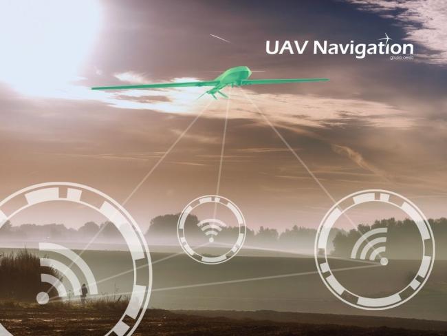
Why GNSS-Denied Navigation Is Becoming Essential for Modern UAV Warfare
Modern UAV warfare is rapidly evolving into a GNSS-contested battlespace where traditional GPS-dependent drone operations are becoming increasingly vulnerable to electronic warfare, spoofing, RF denial, and navigation disruption. From the Russia-Ukraine conflict to emerging EW doctrines across global defence programs, military observations are revealing a critical shift toward resilient autonomous navigation systems capable of operating in GPS-denied environments. This article explores the engineering realities behind GNSS-denied UAV operations, including GPS jamming vulnerabilities, inertial navigation drift, visual SLAM limitations, terrain-relative navigation, onboard AI, edge autonomy, sensor fusion, and RF-resilient autonomous systems. It examines how modern defence UAVs are evolving toward multi-sensor navigation architectures designed for survivability in contested electromagnetic environments. The analysis also covers real-world military observations, battlefield electronic warfare trends, embedded AI constraints, SWaP challenges, visual-inertial odometry, collaborative autonomy, and the growing role of onboard edge compute in autonomous UAV warfare. As defence forces increasingly prioritize resilient autonomy, navigation integrity, and spectrum survivability, the future of unmanned aerial systems may depend less on airframe capability alone and more on whether autonomous platforms can continue operating when satellite navigation becomes unavailable. Aerion Aerospace is a deep-tech aerospace engineering company focused on autonomous UAV systems, embedded AI, resilient navigation architectures, ISR technologies, and next-generation autonomous aerial platforms for defence, industrial, and advanced aerospace applications.
NAVIGATION
Aerion Aerospace R&D Team
6/8/20267 min read
Why GNSS-Denied Navigation Is Becoming Essential for Modern UAV Warfare
Modern UAV warfare is undergoing a fundamental architectural shift.
For nearly two decades, satellite navigation formed the invisible backbone of unmanned aerial operations. Whether for waypoint navigation, autonomous flight stabilization, targeting, swarm coordination, return-to-home logic, or ISR mission execution, most UAV ecosystems evolved around a foundational assumption:
GNSS availability would remain persistent, reliable, and uncontested.
That assumption is now rapidly collapsing.
From Eastern Europe to the Middle East, modern battlefields are increasingly becoming contested electromagnetic environments where navigation itself is under attack. Electronic warfare is no longer a supporting capability operating on the edges of conflict. It is becoming central to battlefield survivability.
And as electronic attack systems mature, GNSS-dependent UAV architectures are revealing critical operational vulnerabilities.
The future of autonomous aerial systems may increasingly depend not on whether drones can fly autonomously under ideal conditions — but whether they can continue operating when satellite navigation disappears entirely.
---
# 1. Why GPS-Dependent UAVs Are Vulnerable
Most modern UAV systems — from commercial quadcopters to advanced ISR platforms — depend heavily on GNSS signals for positioning, stabilization, route planning, geofencing, autonomous navigation, and mission continuity.
This dependency introduces a critical weakness.
Civilian GPS signals arriving from medium Earth orbit typically reach the surface at extremely weak power levels, often near -125 dBm to -130 dBm. In practical engineering terms, these are signals barely distinguishable from background noise.
As a result, relatively low-cost electronic warfare systems can disrupt GNSS reception over surprisingly large operational areas.
Field observations from modern conflicts suggest that tactical GPS jammers with output powers measured in tens of watts can deny civilian-grade GNSS reception across several kilometers depending on terrain, antenna gain, altitude, and atmospheric conditions. Airborne platforms at higher altitudes often become even more exposed due to increased line-of-sight visibility to jamming sources.
This creates a dangerous asymmetry:
A multi-million-dollar autonomous UAV can potentially be disrupted by comparatively inexpensive RF denial systems.
The problem extends beyond simple signal loss.
Modern electronic attack systems increasingly employ:
* Barrage jamming
* Directional jamming
* Meaconing
* Spoofing attacks
* False satellite signal injection
* Coordinated EW saturation
Spoofing is particularly dangerous because the UAV may continue believing navigation integrity still exists.
Instead of immediately failing, the aircraft may:
* Drift off mission
* Miscalculate targeting
* Violate geofences
* Lose synchronization
* Execute false return-to-home paths
* Expose ISR positions
* Crash during terminal guidance
Urban environments further complicate the problem.
Dense urban terrain introduces:
* Multipath reflections
* Intermittent line-of-sight blockage
* Degraded satellite geometry
* Signal attenuation
* False positioning errors
Even without active jamming, urban canyon environments can reduce GNSS accuracy from sub-meter RTK precision to several meters or worse.
For autonomous UAV operations, this degradation is operationally significant.
A reconnaissance drone navigating narrow urban corridors cannot tolerate large localization uncertainty. Similarly, autonomous strike systems operating near friendly forces require extremely high positional integrity.
The challenge becomes even more severe under RF congestion.
Modern battlefields increasingly contain:
* Dense radio traffic
* Mesh communications
* EW systems
* Counter-UAS infrastructure
* Radar emissions
* Tactical datalinks
* Swarm coordination traffic
The electromagnetic spectrum itself is becoming saturated.
And in that environment, GNSS becomes one of the first systems under pressure.
---
# 2. Modern Warfare Is Becoming GNSS-Contested
The Russia-Ukraine conflict fundamentally accelerated global awareness around GNSS-denied warfare.
Both sides have extensively deployed electronic warfare systems capable of disrupting UAV operations across tactical and operational levels.
Numerous battlefield reports and open-source ISR assessments have described:
* GPS degradation near active frontlines
* Disrupted drone telemetry
* FPV drone navigation instability
* Electronic suppression of ISR platforms
* Degraded loitering munition effectiveness
Russian EW systems such as:
* Krasukha
* Zhitel
* Pole-21
* Tirada have repeatedly been associated with broad-area RF denial operations.
At the same time, Ukraine’s adaptive drone ecosystem demonstrated another critical lesson:
Low-cost drones remain operationally valuable only when operators continuously adapt navigation techniques around EW pressure.
This has accelerated experimentation with:
* Terrain-following flight
* Optical guidance
* Visual terminal navigation
* Inertial fallback modes
* Semi-autonomous attack logic
* Onboard vision-assisted targeting
The battlefield has effectively become a live laboratory for electronic warfare adaptation.
The Middle East has demonstrated similar patterns.
Iranian military discussions and regional analyses have repeatedly emphasized:
* Navigation denial
* Asymmetric EW capabilities
* Anti-access spectrum warfare
* UAV interception through electronic attack
Several incidents involving spoofed civilian navigation systems in maritime regions further illustrate how GNSS manipulation is no longer theoretical.
The implications are enormous.
Historically, air superiority largely focused on:
* Kinetic capability
* Radar dominance
* Missile range
* Stealth
* Manoeuvrability
Future superiority may increasingly depend on:
* Spectrum dominance
* Navigation resilience
* Perception reliability
* Autonomous survivability
Even advanced ISR UAVs are vulnerable.
High-altitude platforms relying on GNSS for:
* Terrain referencing
* Coordinated ISR
* Geospatial tagging
* Precision Waypointing can suffer cascading mission degradation once navigation confidence collapses.
At the opposite end of the spectrum, low-cost FPV drones also remain highly exposed because most commercial autopilot stacks were originally designed for permissive civilian environments.
Modern warfare is therefore forcing a strategic realization:
Autonomous systems designed around persistent satellite availability may not remain operationally viable in contested battlespaces.
---
# 3. The Rise of Alternative Navigation Architectures
As GNSS reliability declines under contested conditions, research institutions and defence autonomy programs are aggressively developing alternative navigation architectures.
This shift is reshaping autonomous systems engineering itself.
## Visual SLAM and Visual-Inertial Odometry
Visual SLAM (Simultaneous Localization and Mapping) enables UAVs to estimate motion and construct environmental maps using onboard cameras.
When fused with inertial sensors, Visual-Inertial Odometry (VIO) can maintain relative navigation even during complete GNSS outages.
Institutions including
* Massachusetts Institute of Technology
* Carnegie Mellon University
* ETH Zürich
* KAIST
have conducted significant research in high-speed autonomous navigation and perception-driven autonomy.
DARPA programs such as DARPA
have also accelerated battlefield autonomy research involving distributed navigation and autonomous mobility in contested environments.
However, SLAM is not a universal solution. Operational limitations remain substantial.
Visual odometry performance degrades under:
* Smoke
* Fog
* Dust
* Snow
* Low-texture terrain
* Darkness
* Repetitive environments
* Sudden illumination changes
Feature extraction itself becomes difficult in degraded visual conditions. Compute requirements are also significant.
Real-time SLAM pipelines operating at:
* 30–60 FPS
* Multi-camera fusion
* Depth estimation
* Loop closure optimization can demand several TOPS of onboard compute depending on resolution and environmental complexity.
This introduces SWaP challenges for airborne systems.
## INS and Drift Accumulation
Inertial Navigation Systems remain essential fallback mechanisms.
However, low-cost MEMS-based INS architectures drift rapidly over time.
Typical tactical-grade MEMS IMUs may accumulate:
* Positional drift of several meters per minute
* Heading drift exceeding 1° per hour
* Compounding localization errors during extended GNSS outages
Without correction sources, pure inertial navigation becomes operationally unreliable for longer autonomous missions.
This is why modern architectures increasingly rely on sensor fusion rather than isolated navigation modalities.
## Terrain Relative Navigation
Terrain Relative Navigation (TRN) compares sensed terrain data against preloaded terrain databases.
This technique has been explored extensively in:
* Cruise missile systems
* Planetary landing systems
* Military autonomy research
NASA Jet Propulsion Laboratory has demonstrated terrain-relative guidance approaches for autonomous planetary descent systems, while defence programs continue adapting similar concepts for low-altitude UAV operations.
Terrain matching improves resilience but depends heavily on:
* Terrain quality
* Environmental visibility
* Altitude constraints
* Database freshness
* Onboard processing capability
Flat terrain environments remain difficult.
## LIDAR Localization and Optical Navigation
LIDAR-based localization offers strong environmental mapping capability and higher geometric consistency under certain conditions.
However:
* LIDAR increases payload weight
* Power consumption rises significantly
* Weather interference becomes problematic
* Airborne vibration complicates mapping stability
Collaborative navigation is emerging as another important field.
Swarm systems may increasingly share:
* Localization confidence
* Terrain observations
* Environmental features
* Navigation corrections
* Distributed perception maps
This creates redundancy against isolated sensor failure.
But it also increases:
* Bandwidth demand
* Synchronization complexity
* RF congestion risk
* Distributed compute requirements
The engineering reality is becoming clear GNSS-denied autonomy is not solved by a single sensor.
It requires deeply integrated multi-sensor architectures operating under real-world battlefield constraints.
---
# 4. Why Onboard AI and Edge Compute Now Matter
The transition toward GNSS-denied autonomy is simultaneously driving a major shift toward onboard AI and edge compute.
Because once reliable external positioning disappears, the UAV must increasingly perceive, interpret, and navigate the environment independently.
That requires local intelligence. Not cloud dependency.
Modern autonomy stacks now process:
* Visual perception
* Object detection
* Terrain understanding
* Obstacle avoidance
* Sensor fusion
* Localization estimation
* Flight adaptation
* Mission reasoning
all directly onboard the aircraft. This creates enormous computational pressure.
Real-time autonomy often requires:
* Low-latency inference
* Deterministic sensor fusion
* Continuous environmental mapping
* High-rate control loops
Sensor fusion pipelines frequently operate at:
* IMU update rates above 200 Hz
* Visual pipelines near 30–60 Hz
* Flight control loops near 400–1000 Hz
Latency becomes mission-critical. Even small delays can destabilize autonomous navigation.
For fast-moving UAVs, perception-to-control latency beyond tens of milliseconds may significantly degrade obstacle avoidance performance and trajectory correction reliability.
Airborne compute constraints make this difficult.
UAV platforms remain constrained by:
* Thermal dissipation
* Battery limitations
* Weight restrictions
* Vibration exposure
* Power efficiency
* Cooling limitations
High-performance embedded AI processors improve autonomy capability but also increase:
* Thermal load
* Electrical demand
* System integration complexity
This is particularly challenging for smaller tactical UAVs where every gram directly impacts endurance.
As a result, autonomy research is increasingly exploring:
* Sparse inference
* Event-based vision
* Neuromorphic architectures
* Low-power perception pipelines
* Onboard AI acceleration
Event-based cameras are especially promising because they process only pixel-level changes rather than full image frames.
This dramatically reduces:
* Data bandwidth
* Compute overhead
* Latency
* Power consumption
Neuromorphic approaches may eventually become critical for airborne autonomy operating under severe SWaP constraints.
The strategic implication is important Autonomy is no longer merely a software problem.
It is now:
* A compute architecture problem
* A power management problem
* A thermal engineering problem
* A sensor synchronization problem
* A survivability problem
And in contested battlefields, cloud-reliant architectures become increasingly fragile.
Communication links may:
* Degrade
* Jam
* Saturate
* Intercept
* Disappear entirely
Future autonomous UAV systems therefore require onboard decision-making capability capable of surviving disconnected operations.
---
# 5. The Future of Autonomous UAV Warfare
The future battlefield will likely reward UAV systems that remain operational under uncertainty.
Not merely those optimized for ideal conditions. This is a profound shift in aerospace systems engineering philosophy.
Historically, UAV development focused heavily on:
* Flight endurance
* Payload capacity
* Aerodynamic efficiency
* Communication range
Future autonomous superiority may increasingly depend on:
* Navigation resilience
* Adaptive autonomy
* Perception survivability
* Distributed intelligence
* RF resilience
* Autonomous mission continuity
This is pushing defence research toward:
* Collaborative perception
* Decentralized navigation
* Multi-agent autonomy
* Terrain-aware autonomy
* Adaptive sensor fusion
* Resilient autonomy stacks
The future UAV may no longer rely on a single navigation backbone.
Instead, it may continuously adapt between:
* Inertial estimation
* Optical localization
* Terrain matching
* Collaborative positioning
* RF opportunistic navigation
* Onboard environmental understanding
Autonomous survivability itself may become a decisive strategic capability.
This changes procurement priorities as well. The most operationally relevant UAV platform may not necessarily be:
* The fastest
* The largest
* The longest-range
It may instead be the system capable of:
* Maintaining navigation integrity
* Surviving EW pressure
* Adapting under degraded conditions
* Continuing mission execution despite uncertainty
In many ways, modern UAV warfare is evolving from: “remote-controlled aviation”
toward: “Distributed autonomous robotics operating inside contested electromagnetic battlespaces.”
This transition will fundamentally reshape:
* Aerospace engineering
* Autonomy architecture
* Embedded AI design
* Defence ISR doctrine
* Tactical battlefield operations
At [Aerion Aerospace], we believe the next generation of autonomous UAV systems will require far deeper integration between:
* Onboard AI
* Resilient navigation
* Embedded compute
* Sensor fusion
* Autonomous mission logic
* RF-aware survivability engineering
Because future autonomy may ultimately be defined not by how intelligently a UAV flies under ideal conditions —
but by whether it can continue operating when satellite navigation disappears entirely.
Aerion Aerospace Pvt Ltd
Contacts
+91 9172326773
info@aerionaerospace.in